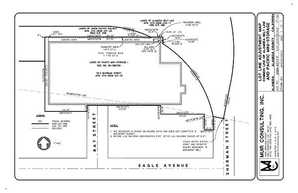
Lot Line Adjustments
There are many reasons for moving the property line. Often, because of the physical layout of the land, a lot line adjustment makes sense. It may be for easier upkeep or a more saleable lot, to merge parcels, for compliance with zoning regulations, or enable one or more property owners to add an amenity, such as a garage or to enlarge their home or building. Another important reason for adjusting a lot line is to correct minor encroachments, such as a garage over the line or in the building setback.
Honoring the Setback
Muir Consulting receives many requests for Lot Line Adjustments to correct minor encroachments that have become major distractions. These are almost always after-the-fact surveys and usually could have been avoided had a Professional Land Surveyor been involved from the beginning of the project, whether for simple fence placement or major building construction. Setbacks are mandated open spaces between structures and the boundary, are necessary for the alleviating conflict with specified utility easements, and to enhance our general well being by allowing space between dwellings. The main question about setbacks is, “How do I know where they are and whom I call for help?” Your local agencies only tell you what they are, not where.
Resolving the Conflict
 There is only one way to confirm and address encroachment issues. A proper boundary and partial topographical survey gathers evidence in regard to the conflict. This information is then taken back to the office, where experienced project surveyors review the data and apply boundary law to properly resolve the boundary. With a resolved boundary, Muir Consulting can suggest various scenarios in regard to establishing a new lot line that respects all the prevailing zoning regulations and maximizes the client’s use of their property. Once the Lot Line Adjustment has been accepted by the local agency, Muir Consulting writes new legal descriptions for both owners which are then recorded with the County Recorder. As an option, the final step in this process involves our crews returning to the field and establishing the new property line.
Recording the Survey
If we do set the corners for the new line, the surveyor must file a Record of Survey with the county. This is a map that graphically shows all of the evidence, measurements, and methodology that was used to determine the boundary. It is reviewed by the county surveyor and recorded at the Office of the Recorder.
